What is LiDAR technology?How does it help with depth measurement?
LiDAR (Light Detection and Ranging) technology is a key innovation in embedded vision systems. Engineers and industry professionals are increasingly finding it vital. This article will thoroughly explore the core principles of LiDAR technology, its diverse applications, and real-world solutions. We'll also look at its future trajectory.
What is LiDAR?
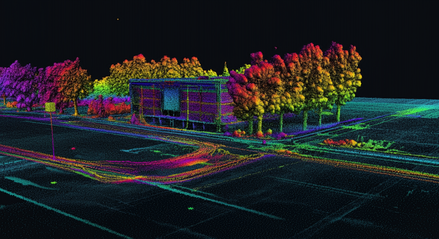
LiDAR, which stands for Light Detection and Ranging, is an advanced remote sensing technology. It precisely measures distances to objects. It does this by emitting pulsed laser beams and calculating the time it takes for these pulses to reflect back to the sensor. This method allows LiDAR scanners to create detailed 3D models, known as point clouds. These models accurately map the contours of objects and their surroundings. This fundamental principle underpins all LiDAR systems.
LiDAR works similarly to radar (RADAR), but there's a crucial difference: it uses lasers instead of radio waves. A LiDAR sensor can emit up to 160,000 laser signals per second. This enables fast and highly accurate measurements of target objects. The formula for calculating object distance is straightforward: Object Distance = (Speed of Light × Time of Flight) / 2. This formula clearly shows how LiDAR technology uses the speed of light and the light pulse's flight time. It ensures highly accurate and reliable measurements. This core function is vital for any depth sensing camera.
LiDAR Meaning: Understanding Its Core Principles
The phrase "LiDAR meaning" directly points to the technology's basic operation: using light to detect and measure distance. This precision comes from several key components that work together within a LiDAR camera system.
Laser Source
The laser source emits laser pulses at various wavelengths. Common sources include neodymium-doped yttrium aluminum garnet (Nd-YAG) lasers. Topographic LiDAR technology often uses 1064nm or 1550nm wavelengths for safety. Bathymetric LiDAR, however, employs 532nm lasers for water penetration. This component is the heart of any LiDAR sensor.
Scanner and Optics
The scanner uses deflecting mirrors to steer the laser beam. This achieves a broad Field of View (FoV) and high-speed scanning capabilities. This dynamic ability is crucial for LiDAR to quickly capture extensive environmental data. It makes LiDAR a powerful 3D depth sensing solution.
Detector
The detector captures the light reflected from obstacles. It typically uses solid-state photodetectors, such as silicon avalanche photodiodes (APDs) or photomultipliers (PMTs). Their high sensitivity ensures that even faint reflected signals are effectively captured. This forms the basis of LiDAR's accuracy.
GPS Receiver and Inertial Measurement Unit (IMU)
In airborne LiDAR systems, a GPS receiver tracks the aircraft's altitude and location. This is critical for accurate terrain elevation measurements. At the same time, an Inertial Measurement Unit (IMU) monitors the vehicle's speed and direction. This ensures the precise positioning of the laser pulses on the ground. These components work together. They enable LiDAR systems to deliver high-precision, high-efficiency 3D depth data, providing robust solutions for diverse, complex applications. This synergy makes a LiDAR camera exceptionally versatile.
How Does LiDAR Work in Practice?
LiDAR systems are generally categorized into two main types based on their operational platform: Airborne LiDAR and Ground-Based LiDAR. Each type has distinct applications and advantages. This shows how does LiDAR work in different scenarios. These variations of LiDAR technology address diverse industry needs.
Airborne LiDAR
Airborne 3D LiDAR sensors are usually mounted on drones or helicopters. They emit light pulses to the ground and capture the returning pulses to precisely measure distances. This LiDAR technology has two further subcategories: topographic LiDAR for mapping land surfaces, and bathymetric LiDAR. The latter uses green light to penetrate seawater, measuring the elevation of seabeds and riverbeds. This makes it an indispensable tool for large-scale environmental monitoring.
Ground-Based LiDAR
Ground-based LiDAR systems are installed on vehicles or fixed tripods. They primarily map natural features of buildings and monitor highways. These systems are also invaluable for creating accurate 3D models of historical sites. Ground-based LiDAR scanners can be mobile LiDAR (for moving vehicles) or static LiDAR (for stationary applications). They offer unparalleled precision for detailed asset management and urban planning.
LiDAR Camera: Real-World Applications
Understanding how LiDAR sensors operate is essential. But their real-world applications truly highlight the technology's immense potential. The versatility of a LiDAR camera makes it invaluable across many sectors, pushing the boundaries of embedded vision systems.
Autonomous Vehicles and Equipment
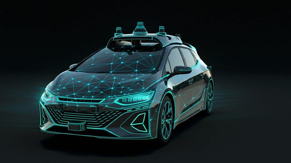
Autonomous machinery, including self-driving cars, trucks, drones, and robotic arms, heavily relies on 3D depth-sensing camera modules. These modules enable obstacle detection, high-precision localization, and environmental mapping. LiDAR sensors provide a 360-degree rotating laser beam. They generate millions of real-time data points to create detailed point cloud maps of the surroundings. This allows vehicles to navigate safely, perform accurate obstacle avoidance, and execute precise object manipulation in various weather and lighting conditions. LiDAR's robust performance makes it a cornerstone of autonomous driving.
Autonomous Mobile Robots (AMR)
In manufacturing facilities, warehouses, retail stores, and distribution centers, AMRs play a critical role. They handle tasks like item picking, transportation, and sorting without direct human oversight. LiDAR is an ideal solution for AMRs. It facilitates quick and efficient object detection and map creation. Compared to other solutions, LiDAR offers lower processing overhead and higher real-time capability for AMRs. This ensures their efficient and safe operation in complex and dynamic indoor environments. This demonstrates the power of LiDAR technology in industrial automation.
Geospatial Mapping and Building Modeling
LiDAR technology is indispensable in geospatial mapping, terrain analysis, and urban planning. It efficiently creates highly accurate Digital Elevation Models (DEMs) and Digital Surface Models (DSMs). This provides fundamental data for land-use planning, flood simulation, and resource management. Additionally, LiDAR is widely used in Building Information Modeling (BIM) and 3D modeling of historical sites. It captures precise geometric shapes and structures of buildings. This supports design, construction, and preservation efforts. This highlights LiDAR's transformative impact beyond just robotics.
Challenges with LiDAR Technology
Despite the significant advantages of LiDAR technology, it still faces several practical challenges. Understanding these helps in designing more effective LiDAR solutions.
Firstly, cost remains a primary concern. High-performance LiDAR sensors are often expensive. This limits their widespread adoption in some mass-market consumer products. Secondly, adverse weather conditions, such as heavy fog, snow, or heavy rain, can severely impede laser transmission and reflection. This reduces the performance and data accuracy of LiDAR cameras. Furthermore, data processing complexity is a notable challenge. LiDAR generates massive volumes of point cloud data. This demands substantial computational power and complex algorithms for real-time processing and analysis. This increases system burden and power consumption.
Lastly, the physical size and integration difficulty of the sensors themselves also need to be addressed. This is especially true for embedded vision systems with strict space and weight limits. Overcoming these challenges will be crucial for the broader spread of LiDAR technology across more industries.
Conclusion: The Future of LiDAR
The arrival of 3D depth sensing technologies, particularly LiDAR, has undeniably changed how we perceive and interact with our environment. From improving the capabilities of autonomous vehicles to streamlining operations in industrial settings, LiDAR's impact is far-reaching. This technology has not only boosted operational safety and efficiency but has also opened new avenues for innovative applications.
As these technologies continue to evolve, LiDAR sensors are expected to become even smaller, more affordable, and more efficient. Their applications will only expand, further integrating into our daily lives and shaping the future of technology. The consistent advancement in LiDAR technology promises exciting breakthroughs.
Sinoseen has over 14 years of rich experience in the embedded vision field. We're committed to helping our customers integrate the right, high-performance camera modules into their products. We've worked with many drone and robotics companies to integrate our depth cameras into their innovative solutions. If you're interested in LiDAR solutions or depth camera modules, feel free to contact us to explore future possibilities.

 EN
EN
 AR
AR
 DA
DA
 NL
NL
 FI
FI
 FR
FR
 DE
DE
 EL
EL
 HI
HI
 IT
IT
 JA
JA
 KO
KO
 NO
NO
 PL
PL
 PT
PT
 RO
RO
 RU
RU
 ES
ES
 SV
SV
 TL
TL
 IW
IW
 ID
ID
 SR
SR
 VI
VI
 HU
HU
 TH
TH
 TR
TR
 FA
FA
 MS
MS
 IS
IS
 AZ
AZ
 UR
UR
 BN
BN
 HA
HA
 LO
LO
 MR
MR
 MN
MN
 PA
PA
 MY
MY
 SD
SD

